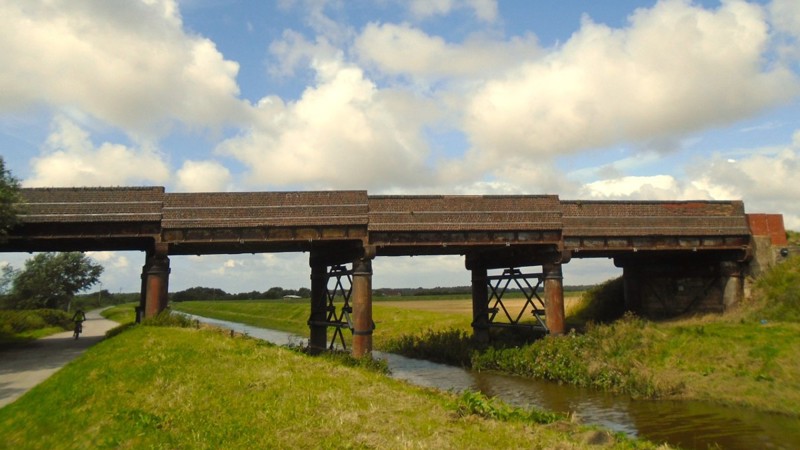
Moss Bridge
Due to the poor condition of the structure, a temporary road closure is in place while investigations are undertaken.
Share this article
Location: Near Formby, Liverpool
Status: Temporary road closure while investigations are undertaken
History
Moss Bridge was constructed in the 1880s as part of extension of the Cheshire Lines Railway to Southport. Since closure of the railway, the bridge has carried Moss Lane over Cheshire Lines Brook and National Cycle Network Route 62, which follows the route of the disused railway line.
About the structure
A programme of planned inspection and investigation work was completed in August 2024 ahead of anticipated refurbishment works due to be completed in 2026.
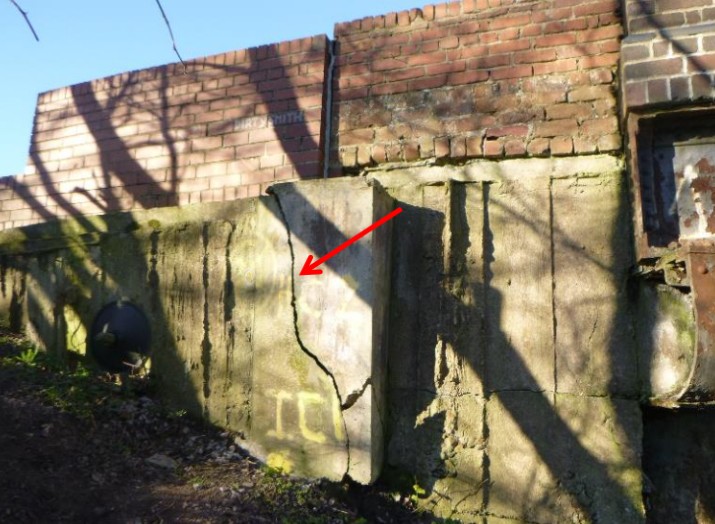
The poor condition of the structure observed at inspection, and evidence of frequent overloading and misuse of the existing 3 tonne gross vehicle weight limit, prompted a closure of the road to all users. The local highway authority actioned this in September 2024.
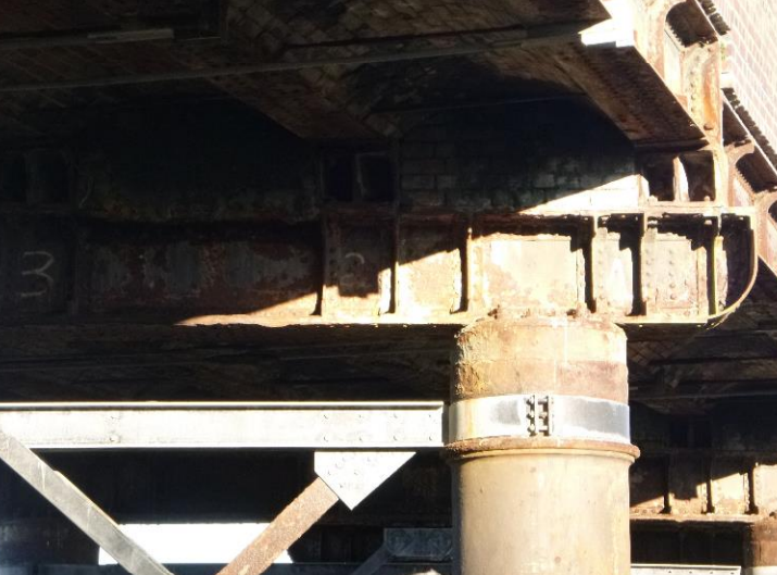
The condition of wrought-iron elements of the bridge were the main concern, with extensive corrosion to structural elements throughout. The closure remains in place to ensure the safety of road users.
The widespread nature of the defects found on the bridge means we've had to reconsider the previously proposed refurbishment project and review wider options for the structure.
What stage is the project at?
We've reviewed the practicalities of carrying out works in this location, which has highlighted some site-specific challenges that we need to explore further to understand what the most appropriate option for the bridge is. These challenges include, but are not limited to:
- the widespread poor ground conditions surrounding the site
- the flood-risk impact of any works in this location
- the presence of protected species on site and access road limitations
Following consultation with the Environment Agency, which owns and manages the watercourse that passes beneath the bridge, it has confirmed that it will be necessary for us to review the flood risk at the bridge before any permits or licences can be granted. This involves further survey work and a hydrology study, which we're hoping to progress as the next main stage of the project.
We're continuing to consult with impacted stakeholders to understand the needs of bridge users and access requirements, which will help inform our preferred solution for the site.
December 2025 update
We're exploring options with our contractors to create a new replacement bridge that could either provide access to vehicles or be opened as a cycle and pedestrian route. We want to know what kind of impact this would have on drivers, cyclists and pedestrians to help inform our future plans.
Depending on the feedback we receive, there are options for any new design to keep Moss Lane closed to vehicles but provide an active travel route to cyclists and pedestrians. Alternatively, a replacement bridge could still carry vehicles depending on demand.
