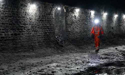
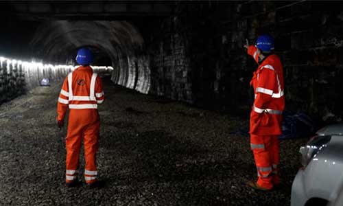
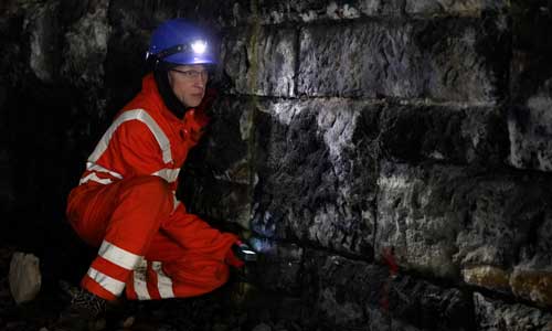
Project profile: Balgray Tunnel
This Victorian disused tunnel is in the West End area of Glasgow, Kelvinside. We’re working with our partners to use innovative survey techniques to better understand the structure and confirm the location of blind shafts along the route of the tunnel .
Share this article
Location: Kelvinside area of Glasgow
Project managed by: National Highways / DfT
Status: Not open to the public
About the structure
Constructed in 1896, Balgray Tunnel was created to carry the Lanarkshire and Dunbartonshire Railway through Balgray Hill. Serving as part of the Lanarkshire and Dunbartonshire Railway, which originally ran from Possil to Dumbarton, but is now almost all but abandoned.
The southern part of the tunnel, at Kelvinside Station adjacent to Great Western Road, was constructed by cut and cover. The northern section of the tunnel’s tightly curved alignment was bored and then lined with brickwork.
The Lanarkshire and Dunbartonshire Railway was absorbed into the Caledonian Railway on August 16, 1909, which then in turn became part of the London Midlands and Scottish Railway at the time of the grouping of the railways in 1923. Nationalisation then followed in 1947.
When the ex-North British lines were electrified in the 1960s, closure loomed for the ex- Caledonian underground route. Although some sections of the railway remained open for freight for a few years, all passenger services ceased on October 5, 1964.
What was the project?
We worked with Geoptic to use cosmic ray imaging on the tunnel. This technology, known as “muon tomography” has been used to scan pyramids, volcanoes, and the Fukushima nuclear reactor complex after the 2011 earthquake.
What work needs to be done?
We’ve already gathered extensive data over the years on the tunnel and how it’s been constructed, but this process will help us confirm our own information, specifically around the location of blind shafts along the route of the 700m tunnel and inform future maintenance interventions. The tunnel was constructed over 100 years ago and the landscape above has changed significantly, so it’s important we have the most up to date information to maintain the structure.
What stage is it at?
The cosmic ray imaging surveys are complete. We will consider using this technique to survey other structures in the estate.
"We’re delighted to be working with National Highways to provide the first HRE muon tunnel survey and we hope this is a collaboration we will be able to continue in the future."Professor Lee Thompson, Technical Director for Geoptic
Image gallery
Use the arrows to browse through the image gallery of the Balgray Tunnel.