National Highways reaches for the skies with new flight management system
National Highways has launched a new flight management system which will speed up processes for drone operators looking to fly near motorways or major A roads and improve safety through better co-ordination and visibility of flights.
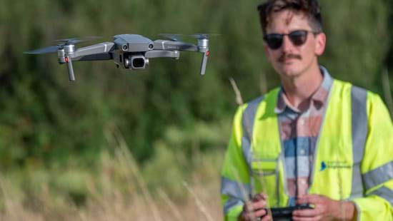
With the use of drones playing an increasing role in modern living, National Highways is introducing a new flight management system which will make it easier to plot use of the drones across the country.
The new system, which launched this week, will speed up the process for drone operators looking to fly near National Highways’ roads and improve safety through better co-ordination and visibility of flights.
It will also share information with such organisations as Network Rail, National Grid and other large companies who also use this system to help prevent conflict with any other flights taking place nearby.
Drone operators looking to fly near National Highways’ motorways and major A roads will be able to go online to enter details of their planned flight. They will then be able to see immediately if other flights and operations are planned in the area and when.
National Highways Drones Governance Hub Chair, Jason Glasson, said:
“Drones are already used for monitoring construction projects as well as surveying and inspecting assets. Drones allow the industry to gather new and richer asset information while minimising risks to workers and road users. They also reduce disruption for drivers as few road closures are required for these activities.
“With usage increasing, we needed to develop a more joined-up approach to appropriately coordinate drone activities near our network.
“Our safety risk governance approach for all drone operations, supported by this new flight management system, will help us safely plan, coordinate and record our increasing drone operations while maintaining safety for our workforce and people living near to the road network.”
Currently, drone operators from the supply chain and contractors have to contact National Highways to supply the necessary paperwork such as risk assessments and have their request accepted. They then notify National Highways ahead of any flights and the business carries out checks to ensure there are no conflicts.
In the last two years there have been over 1,000 notifications with the number of flights continually increasing.
Under the new system, developed by DroneCloud, operators will be able to go online to record their flight details and discover within seconds whether that will cause conflict with other aircraft. In addition, there will now be details of flights booked with other organisations such as Network Rail.
The system works alongside a new Drones Standard, GG 954 Drones Operations. This replaces the existing policy and contains requirements over and above those defined by the regulator, the Civil Aviation Authority.
It also aligns with the company-wide GG 104 standard which will ensure that the use of drones is safer, or at least as safe as, the existing way of undertaking an activity whether that be, for example, surveying, construction or asset inspection.
Notes to Editors
National Highways is the wholly government-owned company responsible for modernising, maintaining and operating England’s motorways and major A roads.
Real-time traffic information for England’s motorways and major A roads is available via the Traffic England website, local and national radio travel bulletins, electronic road signs and mobile apps. Local Twitter services are also available.
For further information please contact National Highways' press office (24hrs) on 0844 693 1448 and select the most appropriate option:
Option 1: National enquiries (9am to 5.30pm) and out of hours for urgent enquiriesOption 2: North West (9am to 5.30pm)Option 3: Yorkshire and North East (9am to 5.30pm)Option 4: West Midlands (9am to 5.30pm)Option 5: East Midlands (9am to 5.30pm)Option 6: East (9am to 5.30pm)Option 7: South East (9am to 5.30pm)Option 8: South West (9am to 5.30pm)
